 Lacey Green, Buckinghamshire.
Pink Road - Brimmers Farm - Pyrtle Spring - Wardrobes - Widmer Farm
A Circular Walk of approximately three and a half miles.
© Dennis Claydon 1998-2012
Map
LGWalks Home Page
At Parslow's Hillock is the "Pink and Lily", a favourite inn of the young poet Rupert Brooke, in the days immediately prior to the Great War. Maybe a walk along this open stretch of road from Lacey Green, prompted him to reflect on, "White mist about the black hedgerows, The slumbering midland plain...", in his work entitled "The Chilterns". Memories of visits to the "Pink and Lily" may have been in his mind, when he wrote:
"I shall desire and I shall find
The best of my desires;
The autumn road, the mellow wind
That soothes the darkening shires,
And laughter, and inn-fires."
A few lines of doggerel by Brooke are preserved at the "Pink and
Lily".
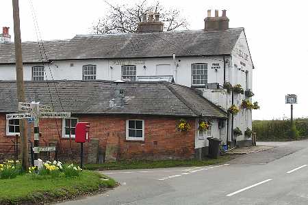
The Pink and Lily. Their web page
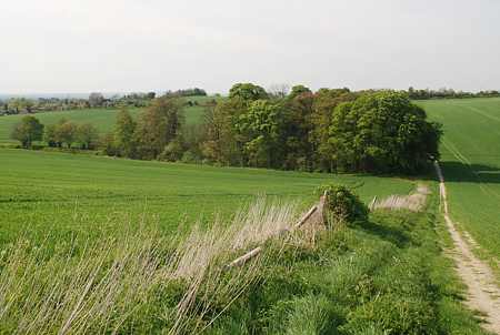
From the crossroads by the Windmill, at the northern end of Lacey Green, turn into Pink Road, which leads to Parslow's Hillock.
For a mile this road follows the edge of the escarpment, overlooking the Vale of Aylesbury, giving one of the best panoramas in the whole of Buckinghamshire.
A short distance past the Inn, on the left at the bend in the road is Bridleway L17.
Bridleway L17, Parslows Hillock to the Parish Boundary
at the junction of Footpath L16, Hillock Wood.
Map
A number of woodland birds find a suitable habitat in Hillock Wood. The silent observer may be lucky enough to see the gold crest, one of our smallest native birds. The chiffchaff, a summer visitor to Britain, may also be spotted together with the blackcap, recognisable by its distinctive colouration of the head.
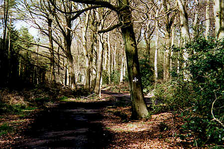
The walk is well waymarked. The arrows on the tree mark the junction.
Follow the bridleway, L17, along the drive, which almost immediately bears right to a bridlegate, and enters Hillock Wood.
Continue along this well maintained Bridleway for about one hundred metres and turn left at the waymarked crossing path.
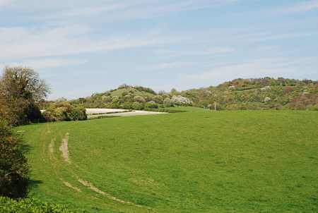
Kop Hill, easily distinguished by its unusual shape, became famous in the 1920's as the scene of many hill climbs by the drivers of early cars and motorcycles. The Hill Climb has been revived and been held annually in September for the last few years.
The outcrop of the Hill is also known as Soldiers Mount or Plum Pudding Hill and may have been a Roman lookout post. A number of Roman coins have been found on the summit and there is evidence of Roman occupation in the valley just below, beside Pyrtle Spring. It has been suggested the site of a Roman Villa may await discovery here.
A local legend relates that if, on the night of the mid winter full moon, the Hill is circled seven times, a Roman soldier on a white horse will appear. If approached, he will obligingly present one with a bag of gold.
Windsor Hill is the site of a nature reserve under the care of the Berks, Bucks and Oxon Wildlife Trust, (B.B.O.W.T.) . It is only open by application to the Trust.
Running down from Parslow's Hillock, through the woodlands on the escarpment to the north-east, is the Black Hedge. The Hedge, which contains much blackthorn, hence the name, is claimed to be the oldest in the country. At the northern foot of Windsor Hill it emerges briefly as a division between two fields. Planted when hedges were first used in making boundaries, it is reputedly at least a thousand years old. It marks the extent of Monks Risborough Ecclesiastical Parish, the earliest recorded parish in the land, and is referred to in a Saxon Charter of A.D.903. It also serves as a modern day boundary between the civil parishes of Lacey Green and Great and Little Hampden.
At certain times and seasons of the year dark circles appear in the field to the right of the path, under Windsor Hill. It is not possible to see them at ground level, but they are sometimes visible from an adjacent vantage point. The circles are distinguishable as crop markings, and particularly after snow around February time. Although there is no known evidence of early occupation in this valley, it has been suggested they might represent the site of hut circles.
To the left of the stile is Winchester Wood Reservoir. This is one of Thames Water Authorities main reservoirs. Skilfully built into the hillside to blend with the surrounding countryside, it contains 13,500,000 litres of water, but not a drop can be seen!
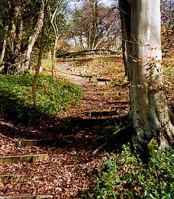
One hundred and eighteen steps.
The path winds gently downhill through a larch plantation before entering mixed woodland and descending very steeply, down a series of one hundred and eighteen steps, to a stile.
Widespread views extend over Buckinghamshire and Oxfordshire. Closer to hand, Kop Hill rises in the foreground, with Windsor Hill to the right, in the sweeping curve of rising escarpment to the north-east.
From the stile continue straight ahead, keeping the boundary fence to the right.
The path descends through the fields, crossing two more stiles, until it reaches a road, opposite Brimmers Farm.
This path, together with the route to Pyrtle Spring, forms part of the six mile Princes Risborough Circular Walk, one of several that have been prepared by Buckinghamshire County Council.
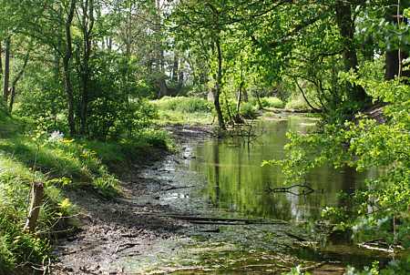
Evidence suggests the surrounding area was occupied as early as the fourth century AD. In the past, possibly from the time of the Doomsday Survey onwards, this Spring produced a stream sufficient to power watermills in Culverton and Princes Risborough.
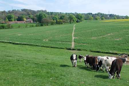
The clump of trees around Pyrtle Spring.
Pyrtle Spring, April 2009.
Whiteleaf Cross
This is one of two turf cuttings in the Chilterns. Among the earliest references to the Cross is an engraving, dated 1742. Its origins remain unknown however, though historians have suggested it may date from prehistoric, Anglo-Saxon or medieval times.
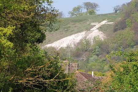
Whiteleaf Cross from The Ridgeway near Risborough school
The chalk surface has in recent years been renovated to a pristine white condition, and the barrow above restored to its former shape after an archaeological investigation.
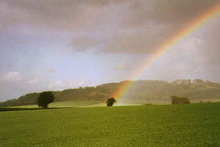
The other end of the rainbow was, of course, in Lacey Green.
Running across the side of the hill to the south-west, more visible in certain shades of light, are a series of ridges. These are thought to be cultivation terraces or "lynchets". If so, they are remnants from the common field system, an important element in Saxon or medieval communities.
For many centuries Lacey Green, Loosley Row and Speen formed part of the Parish of Princes Risborough. These, together with Culverton, were known, rather appropriately, as the "Upper Hamlets".
This path, known as "Churchway", takes a direct route between the Upper Hamlets and Princes Risborough Parish Church. The tip of the spire may be seen behind to the north-west. Generations of inhabitants from the "Upper Hamlets" have followed this ancient track, in times of joy and sorrow, to visit their Parish Church.
Turn right and follow Brimmers Road, north-westwards towards Princes Risborough, for a quarter of a mile, before entering a hedged track on the left.
This, Bridleway R6, marks the Parish Boundary. Shortly, climb a stile on the right into a field, entering Princes Risborough Parish, and follow Footpath R5 to the clump of trees in the distance that surround Pyrtle Spring.
Just before reaching the protective belt of trees around the Spring, turn left onto Footpath R4b.
This path climbs slowly, with a fence on the right, to reach a stile in a crossing hedgerow and re-enters the Parish of Lacey Green.
Wardrobes House and Little Wardrobes are both listed buildings.
Wardrobes House, of red and vitreous brick, together with its associated Granary to the north-east, were constructed in the early nineteenth century. Little Wardrobes (Wardrobes Farm House) was built in the mid to late eighteenth century and incorporates a seventeenth century chimney, with later nineteenth century extensions.
Access was once via the small valley the path crosses. The Enclosure Award of 1823 refers to this valley as "Stepnall Furlong", probably meaning "steep narrow valley"
Wardrobes is one of the more unusual place names of Buckinghamshire. The name probably derives from the Wardrobes family who held property in Aylesbury. Juliana atte Wardrobes demised land here in 1338.
Path near Wardrobes House.
Where the path meets the road, Woodway, is a fine horse chestnut tree. During the spring it gives a brilliant display, with candles of white bloom. Later in the year, the fan shaped leaves, in a range of colours, are resplendent in autumnal glory. Under the boughs of this spreading chestnut tree a seat has been thoughtfully provided to enjoy a distant view over the site of the former Goodearl-Risboro Ltd furniture factory as well as the surrounding countryside.
On the right of Woodway are a pair of houses, Woodway Farmhouse and Woodway House. These houses date from the late sixteenth early seventeenth century, but were reconstructed about a century later. The left half, rebuilt in flint with brick dressings, has a thatched roof. The right half, of irregularly chequered brick with first floor band couse, once served as a public house.
The path continues across a field, heading roughly in a south-easterly direction, towards the village of Loosley Row in the distance. The house in the foreground is Wardrobes House.
Crossing a stile the path descends into a "hidden" valley. Over a further stile, and the path climbs gently maintaining its generally south-easterly direction, to join a boundary hedge on the left.
Follow the hedge, which passes close to Wardrobes House and Little Wardrobes.
After crossing the drive of Wardrobes House, via two stiles, continue ahead, with the boundary hedge on the left, to a further stile.
Maintaining the same south-easterly direction, head across the field to another stile, leading to a final field and stile, and emerge onto a road at the junction of Woodway with Wardrobes Lane, Loosley Row.
Follow the road (Woodway) up the hill towards Lacey Green for just under a quarter of a mile and take the footpath on the left, which is opposite the properties Springbank and Oakhill House. Take care on this short, narrow and busy section of road without a pavement.
Widmer Farm boasts an animal and pet centre, together with an equestrian centre. Apart from the horses, the observant may also spot llamas grazing the surrounding fields.
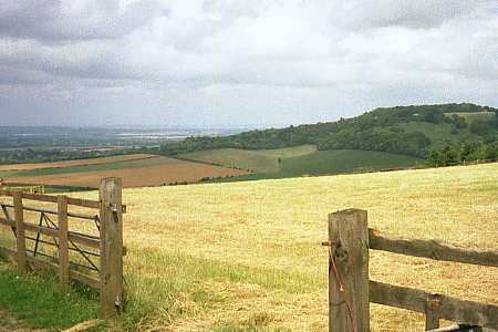
From the Pink Road, towards Kop Hill.
Cross this stile and immediately climb another stile on the left, beside a field gate. Turn right and keeping the boundary hedge to the right, continue up the hillside. The path continues to rise to a third stile and upwards still to a fourth stile beside a field gate, leading into a farm track.
Cross the farm track to another stile. Still climbing, head diagonally across the field in a generally north-easterly direction, taking an area of woodland on the horizon as a guide. On reaching the summit a stile in the corner of the field leads into Pink Road opposite Widmer Farm.
From the stile into Pink Road, turn left for Parslow's Hillock or right for Lacey Green.
> Lacey Green Village. Local history, the Windmill and other pages (This website's home page)
A Glimpse of the Promised Land A circular walk, with views over the Saunderton Valley.
The Speen Alps Another walk. Through the woods and fields around Speen.
Many Photos of Buckinghamshire and Beyond
The Pink and Lily's web page