 Lacey Green, Buckinghamshire.
Speen Baptist Church - Walter's Ash - Speen Farm - Turnip End -
Monkton Wood - Coleheath Bottom.
A circular walk from Speen of about five miles.
© Dennis Claydon 1998-2012
LGWalks Home Page
Denner Hill land speculation: Hughenden Valley Residents Association
|
An Introduction to Speen
The village lies about two miles south-east of Lacey Green, forming part
of Lacey Green Parish. The community has a long history, recorded in the book
'The Leaves of Time' by Martin Stockley and Bob Johnston, produced to mark the Millennium in 2000.
Set upon a small plateau, it is embraced on three sides by the arms of
the Iron Age earthwork, Grim's Ditch. This has given rise to the theory
that the village might mark the site of an ancient settlement in the Chilterns.
However, this theory is very difficult to prove and is a matter of conjecture.
The origin of the name is somewhat obscure. Since the area was once surrounded by common woodland, the name may possibly derive from "Spene", "Spinis" or "Spinae", meaning "the hawthorn", or "Spon", meaning "wood shaving". Certainly an entry in the Black Prince's Register of 1351 refers to "... Spene in the Prince's Manor of Risborough" A nineteenth century Methodist Cleric records conducting an open air service in "Spien" on the eighth of August 1836. An estimated congregation of four hundred persons listened attentively to his sermon. The reason for his visit was two men in the village had been fighting, one killing the other, while engaging in organised bare fist fighting. Over a period of six months no less than three people within five miles radius had been killed due to fighting. The brother of the man killed at Speen had killed another and was in prison. It was thought a visit to the village at such a time would do good. Jonah Hammond and Daniel Currell, had become engaged in such a fight, with James Williams acting as "second" for Hammond, while Thomas Stevens attended Currell. Hammond, after two or three rounds, became totally exhausted and collasped to the ground. Immediately, Thomas Stevens, Currell's "second", hauled Hammond to his feet and supported him, whilst Currell continued to rain blows on the victim. Once again Hammond fell to the ground, striking his head on a stone in the process. This caused serious head injuries which led to Hammond's death. Currell was found guilt of manslaughter.
The village playing field, occupying a central position, was purchased in 1935. It has proved to be a fine asset to the community and is "open for the enjoyment of all". Brick and flint cottages, some reputedly dating back over four centuries, are now intermingled with those of modern construction, skillfully blended to match. Today the village contains no less than fourteen listed buildings, dating from the fifteenth to the nineteenth century. Approaching Speen from the south east one of these is Speen Baptist Church in Chapel Hill.
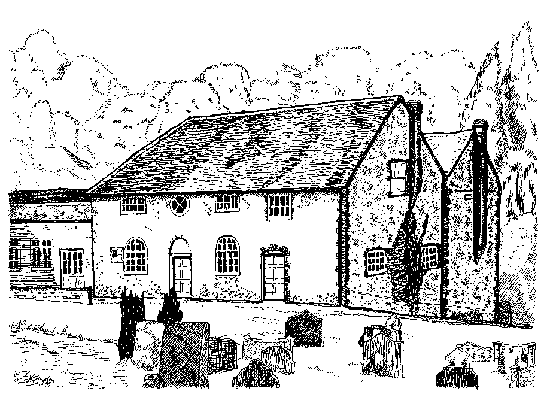
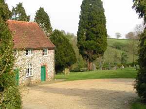
Speen Baptist Church
This building of brick and flint, erected in 1802, is the oldest place
of worship in the Parish. It is said to have been constructed by men of
the village. To supply the building materials the ladies collected flints
in their aprons from the surrounding fields, assisted by the children,
which they brought to the site.
The inscriptions on the stones in the neatly kept cemetery provide an insight into the lives and occupations of many past inhabitants. One records an accident of 1838 when a man lost his life after falling from his cart. The headstone was erected almost sixty years after the event. Another simple stone marks the resting place of Eric Gill, sculptor, printer, writer and designer. The last twelve years of his life he spent at nearby Piggotts. Amongst his stone works were stations of the cross in Westminster Cathedral, carvings for the underground station at St. James Park, Broadcasting House and the League of Nations building in Geneva. He was also commissioned for work on the Anglican Cathedral in Guildford. He designed eleven faces of printing type which have changed modern printing.
|
Speen Baptist Church
The Circular Walk
|
|
A little to the north-west of the Baptist Church, is Pye Corner, leading off Chapel Hill. Follow the track for a few paces, heading south eastwards, to the rear of the double garage on the right belonging to Pye Cottage, and enter the signposted path, Footpath L38. This path, together with Footpath L38A forms part of a continuous way to Walter's Ash, largely following the Parish Boundary, but alternating between the civil parishes of Lacey Green and Hughenden. Ascending three or four steps the path begins to climb slightly, following the boundary hedge and fence around the garden of the property. This leads, in a very short distance, into a hedged path and a gate. Through the gate into a paddock and continue climbing, with the hedge now to your right, to a second gate. Continue following the hedge to a third gate. The path, having reached its summit, now marks the Parish Boundary. With the hedge to your right, cross a level field, to a fourth gate. There is a junction of footpaths at this point. Just to the right is Water Lane Pond. Watch for the Pond's "resident" heron standing on guard duty, possibly surrounded by a small, but lively contingent, of visiting mallard ducks.
|
|
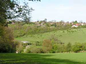
Spring Wood To some inhabitants of Speen this piece of woodland is known as Spring Wood. It is, however, marked on the Ordnance Survey as Guy's Spring. Descending the woodland track, views extend to the right into the deep valley forming Flowers Bottom, and also towards Speen Farm on the opposite hillside.
|
After going through the fourth gate at the junction, bare left then almost immediately turn right, keeping the hedge and post and rail fence on your right. Although still following the Parish Boundary, this section of the path is in the Parish of Hughenden. For a short distance there are widespread views to the south, before the path begins to descend towards a stile and field gate at the entrance to Spring Wood. On crossing the stile, there is a clearly defined track, along the edge of the wood, down to the valley bottom.
|
|
To Walter's Ash
Still following the Parish Boundary, the path has transferred back to the
Parish of Lacey Green as Footpath L38A. Not only does this section mark
the boundary of the civil parish, but also that of the County and European
Constituencies.
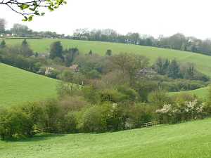
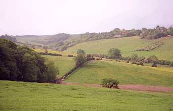
As the path rises towards the summit, ever increasing views extend back towards Speen. From here is well illustrated the windings, typical of the deep dry valleys, or "Bottoms", of the Chilterns. The rolling landscape spreads away northwards towards Flowers Bottom and Highwood Bottom. To the south-west, in another valley, lies Upper North Dean. To the north-west is an area of woodland known as Speen Farm Firs. The firs seem to have largely disappeared and to have been replaced by mixed woodland.
Sandstone
Amongst the area of hedgerow and trees are
some deposits of sandstone. This material was once the source of a flourishing
local industry, dating back to at least the mid nineteenth century, if
not earlier.
The best deposits of this stone were to the north of High Wycombe, - Bryant's Bottom, Denner Hill, North Dean, Naphill and Walter's Ash. These blocks or boulders of hard sandstone were found at depths varying from six to sixty feet. They were located by workers probing the ground with long instruments known as "snipers". The blocks varied in size, one at Walter's Ash was reported to be around twelve feet in height and weighing over three hundred and fifty tons. These blocks were split to produce cobbles, kerbstone "setts", building blocks, river stepping stones, cottage door steps and gateposts. Building blocks were used in the repair of Windsor Castle. Some streets, in both Windsor and Aylesbury, are paved with this stone. |
|
|
The Brickmakers of Walter's Ash
The area now covered by the Married Quarters and the nearby scrubland was
once the site of another flourishing industry, brick making.
The brick makers of Walter's Ash, Brown Brothers, Thomas Free and Sons and Bristow Brothers, produced an expensive, high quality product. This was the site of Bristow Brothers brickfield. Walter's Ash bricks were probably first produced early in the nineteenth century, and the industry continued on this site well into the mid twentieth century. As a result of this trade, large pits were left when the clay deposits ran out. Once, the walker had to negotiate a path weaving around the many deep excavations, but this danger has long since passed.
North-eastwards there are views across the valley towards Speen Farm with the village of Speen beyond.
|
|
|
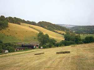
Speen Farm
The Farmhouse, with two adjacent barns, forms an attractive group of listed
buildings. The house has a cross wing dating from the fifteenth century,
but the main range was erected about 1600. The whole was rebuilt in flint
with brick dressings around 1800. The barn to the south-east, dates from
the mid to late eighteenth century. During the early 1980's this building
was much restored and converted into a large function room. The small barn,
twenty yards east of the Farmhouse, is of late eighteenth century construction.
Early in the nineteenth century, the then owner of the farm, Thomas Dell junior, was in contention with the Lord of the Manor, regarding the latter's claim to surrounding woodlands. This was at a time leading up to the Enclosure of Princes Risborough Parish, however, the matter was satisfactorily resolved. For the first quarter of the twentieth century the Hatt Brothers worked the Farm. It was a difficult time for agriculture and to supplement their meagre income they arranged the carting of timber. Using a timber-bob, a large wooden trailer drawn by four horses, they conveyed beech trees from the surrounding woods to the furniture factories of High Wycombe. Considerable skill was required to manoeuvre these vehicles along logging tracks and narrow country lanes.
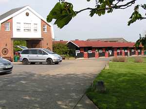
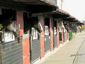
The Horse Trust - Home of Rest For Horses
Speen Farm is now the The Horse Trust - Home of Rest for Horses. This independent Society
was founded in 1886 by Miss Ann Lindo, to provide a retreat for working
horses from the streets of London. After being housed at various locations
in and around London, the Society moved to Speen Farm in 1971.
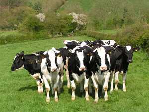
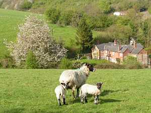
Approximately two hundred horses, ponies and donkeys pass through the stables each year. Some horses come to take a rest from work, others to retire when their working life is over. One former resident was Sefton, retired from the Household Cavalry, in 1982, after the bomb attack in Hyde Park.
The Horse Trust is open to visitors. A link to their web-site is at the bottom of this page.
|
From the car park, follow the waymarking between the stables and outbuildings of Speen Farm, to a stile beside a field gate. Cross the stile and follow the boundary hedge to the left, heading downhill. In a few yards turn left, over a double stile into a field, Footpath L47.
|
|
Old Plow Inn
The Old Plow Inn was reputedly opened in the year 1610. One of its early
customers is said to have been the famous diarist, Samuel Pepys, who reported
the brew of his day to be exceedingly fine. The Inn attracted widespread
fame in the 1930's when Ishbel MacDonald, the daughter of Prime Minister,
Ramsey MacDonald, became its hostess.
Over the course of time the Inn sign seems to alternate between the agriculture implement and the constellation of heavenly bodies. This establishment is now a restaurant of high standing.
|
From the highest point of this path views extend northwards, over the deep curving valleys of Highwood Bottom and Flowers Bottom. In Flowers Bottom is the Old Plow Inn. The path heads north-westwards diagonally downhill. As a guide make for the right hand side of the cottage ahead, locating a stile in the hedgerow, leading into Flowers Bottom Lane. Turn left, continuing up the lane for a few yards, then turn right into a rough track, Right of Way L46.
|
|
Darvills Hill
The handful of cottages around this junction form the community of Darvills
Hill. To the left, beyond its gateposts of "Denner Hill Stone" is the colourwashed,
tiled farmhouse, of Darvills Hill Farm. Darvills Hill has been "home" to
generations of the Anderson family. Trade directories, spanning almost
a century, describe various members of this family as Farmers, Wheelwrights,
Undertakers, Builders and Smallholders. An example of the versatility and
independence which existed in small rural communities during the nineteenth
and early twentieth centuries.
Turnip End
Some authorities suggest the name Turnip End may derive from the "Cornish", meaning "within the chief earthworks". This could refer to the protective arms of Grim's Ditch which, although half a mile, surround the area on three sides. Darvills Cottage is an early eighteenth century listed building, although altered and extended. It was in earlier times two small cottages, but is now converted into one dwelling. For a short time during the 1960's it was the home of the famous model, Jean Shrimpton. |
Continue to the very end of the track adjacent to two cottages. Another pair of "Denner Hill Stone" gateposts is half hidden in the hedgerow here. A feature common to several of the footpaths of Speen is that they pass through private gardens. From Turnip End Lane join Footpath L26, by entering the garden of the house on the right, Darvills Cottage. Follow the waymaking and head for the right hand side of the building, continuing along the side of the cottage to cross a stile into a small paddock.
|
|
Parish Ponds
Most of the Parish Ponds have
long since disappeared, but four still survive, one of which is here at Turnip
End.
Before the advent of mains water during the 1930's, this area of the Chilterns was prone to drought. Prior to this date water for domestic purposes was either collected from cottage rooftops and stored in underground tanks, or, obtained from the Parish Ponds. The Princes Risborough Enclosure Award map for the "Upper Hamlets", dated 1823, gives details of the various ponds within the Parish. Some of their names: Timor, Deep Pit, Black Pit, Whitewashing and Baggy's, are curious and intriguing. Some were known as "keaching" ponds, used for domestic purposes, whilst others were reserved for the use of cattle. The right still exists for any parishioners, if they so wish, to draw water from these ponds.
|
Go ahead for approximately one hundred yards to a third stile by a field gate. Here Footpath L26 meets with Footpath L25. At this "T" junction turn left onto the concrete track, Footpath L25.
|
|
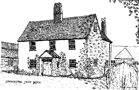
Stocken Farm, Lacey Green.
To the west is Stocken Farm. The Farmhouse and an older barn, hidden from
view by the modern farm buildings, are listed buildings dating from the
seventeenth and eighteenth century.
The Farm covers an area of 190 acres, comprising a dairy herd and arable. It is the home farm, the buildings and machinery of which serve altogether around 800 acres. The present owners have traced the history of the Farm back to the days of the first Queen Elizabeth.
|
Views extend south-eastward towards the village of Speen and to the north-east along Highwood Bottom in the valley below. The concrete farm track climbs gently for about one hundred and fifty yards, before reaching the summit and levelling out. On the skyline, to the north-west, the sun may just reflect off the white sails of Lacey Green Windmill through the trees. To the north, a line of trees mark the course of Grim's Ditch, en-route to Great Hampden.
|
Stocken Farm
|
"Bomber" Harris
To the south-west, on the skyline, rising above the tree tops, a mast marks
the headquarters of RAF Air Command, which controls the Royal Air Force's
combat aircraft.
During the Second World War this was the headquarters of Bomber Command, under the command of Air Chief Marshal Sir Arthur "Bomber" Harris. The area of flat land to the south-east of this footpath was requisitioned from Stocken Farm and put to use as a wartime airfield. From here Sir Arthur flew his light aircraft on numerous trips to France. This was the second occasion during the farm's long history that it had been requisitioned by the authorities. During the First World War part of the land was taken over by the Royal Engineers for training. Horses were stabled in the farm buildings and the house used as a hospital.
|
|
|
Grim's Ditch
A short part of this walk runs along the course of the ancient earthwork
known as Grim's Ditch. At this section bank and ditch are some thirty feet
wide and ten feet deep.
The earthwork may be traced, at intervals, for sixteen miles across the Chiltern countryside, from Bradenham in the south-west to Berkhamsted in the north-east. Referred to by one writer as "the silent serpent of antiquity", its origins are obscure. The name of the Ditch is said to derive from folklore, which attributed any mysterious earthwork to the Devil, sometimes known as Grim, - hence Grim's Ditch. Experts have long debated the date of this earthwork. Some considered it to be of Anglo Saxon origin, whilst others favoured the Iron Age period. In 1992, after further archaeological research, it was proved to date from the Iron Age, around 300 BC. This makes it one of the most important prehistoric works in Buckinghamshire. It is clear the earthwork must have been surveyed at the time of its conception. Throughout its course the Ditch lies about half a mile back from the escarpment edge. The remains seen today are but a shadow of their former size. The whole project must have been a mammoth undertaking, clearly the work of many hands and resources. It is possible the Ditch was constructed over a period of years. It is generally agreed the work is of a non defensive nature. Its purpose may have been to form some kind of tribal boundary, or as a division between upland and lowland pasture. From the Ordnance Survey map it will be noted the Ditch turns at right angles in Lacey Green and again in the vicinity of Great Hampden. The earthwork thus embraces Speen on three sides.
|
|
|
White House Farm
The stony track of Bridleway L24 was formerly part of an ancient road,
which, during the eighteenth century, lead from Princes Risborough to Speen.
Over the centuries it has changed its course several times. The alternative
routes have also long disappeared, until Bridleway L24 is now the only section
which still survives.
Half a century and more ago White House Farm comprised a small cottage, a barn and a range of outbuildings with some six acres of land. The owner managed to make a living from a few milking cows, rearing calves, poultry and the produce of an orchard, whilst supplimenting his income producing wooden chair parts for the local furniture industry. One of the highlights of the owner's year was his annual visit to Ascot Races. His wife, who was probably "financial administrator", did not wholly approve of this annual excursion. However, a neatly dressed figure could be seen during Ascot week, making his way on foot to Princes Risborough Station. Since those days the house has had a variety of owners. Amongst these have been Mrs. Haynes Dixon, better known as the authoress Rumer Godden. It was also the retirement home of Major General Sir Colin Gubbins. During the early days of the Second World War he established the underground resistance movement in Britain, poised to act in the event of a German invasion. He later became Director of Operations and Training at Special Operations Executive (SOE), with full responsibility for secret missions to Western Europe. Finally he was appointed head of SOE in 1943.
|
|
|
Kingswood House
Like White House Farm, the original Kingswood House was formerly a farm, with fifty
acres of land and a range of farm buildings. These consisted of stables,
barn and a milking parlour arranged around a yard. The original buildings were probably
erected around the middle of the nineteenth century but have now been replaced by modern sturctures.
A beam in the barn certainly bore the date "1855", and was inscribed "Ward, Carpenters, Speen."
Kingswood Farm once "grew" a fine crop of stones. Before the days of tarmacadam roads many tons of flints were supplied to the highway authorities to help maintain the local roads in good repair. In the early twentieth century a freak thunderstorm caused a build up of water in the valley to the north of the farm. The force of the water was such that an iron pig trough was carried a hundred yards from the farm into the road. A similar incident occurred in 1991, again as a result of a very heavy storm. Water, which accumulated at the head of the valley to the northwest, caused a torrent to flow across the fields, removing earth to a depth of eighteen inches. Following the course of the valley, the water, six inches in depth, cascaded along this path, into Flowers Bottom.
|
|
 Over Flowers Bottom towards North Dean.
 Bridleway beside Grim's Ditch.
 Overlooking Highwood Bottom.
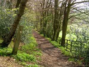
 Path near Kiln Lane.
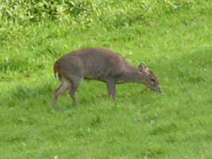 Wild muntjac deer.
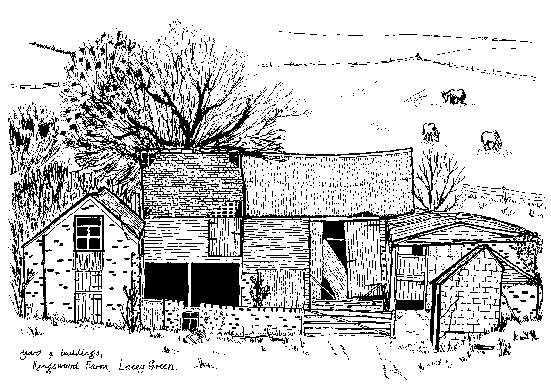
The former outbuildings at Kingswood Farm.
|
Coopers Grave
Until well into the nineteenth century most of this section of the ancient
road, except for a small area on the south side, passed through woodland.
Back in the far off days of the eighteenth century a notion grew up that
all the inhabitants of the Upper Hamlets (i.e. Speen, Lacey Green and Loosley
Row.) were extremely well endowed financially. A myth that seems to have
filtered through to the twenty-first century!
However, during the seventeen hundreds, the fact that the good people of Speen, carrying their heavy purses and bags of gold, were using this route to visit Princes Risborough, was noted by a highwayman named Cooper. He began to work this road with good results, so much so that when he died he too was a very wealthy man. It is said that he is buried, together with his vast treasure store, beside this road, the spot being marked by two large stones. Here, at the junction with Bridleway L30, those two stones remain and may be seen in the hedgerow. Reputedly, his ghost still haunts this valley on crisp, clear moonlight nights. The foregoing is the Speen version of the story. There is, of course, a far less romantic Lacey Green version. It is said there was once a lady named Nannie Cooper, who probably lived during the eighteenth century. She may have been connected with the management of Stocken Farm, but this is uncertain. A rather eccentric person, she would visit a pond to the south-east of the farm, taking with her a large bucket and a length of rope. Attaching the rope to the bough of an overhanging oak tree, she would climb into the bucket and swing back and forth across the surface of the water. Either by accident or design, but probably the latter, she is said to have fallen into the pond and drowned. These stones are said to mark her grave. Were not suicides once buried in unconsecrated ground, at cross roads, on the edge of the community? True, this is a "T" junction, but it is on the borders of both villages. There are two pieces of positive information regarding this story. The field where the pond was situated is refered to as "Coopers Pond" on an old farm map of 1872. Some years prior to the Enclosure of 1823, the Commissioners surveying the Parish produced a map, which is preserved at the County Record Office in Aylesbury. This map records Footpath L24, not as Highwood Bottom or Speen Bottom, but as "Coopers Grave Bottom". The reader must be left to draw their own conclusions from the above stories, but doubtless the silent stones will keep their secret.
|
This is Highwood Bottom or Speen Bottom as it is marked on some Ordnance Survey maps. This junction also marks the boundary between the villages of Speen and Lacey Green.
|
|
Highwood Bottom
Just to the south of the small tract of woodland lie the cottages which
form the community of Highwood Bottom.
Edmund Rubbra, the composer, made his home here in the 1930's. His wooden "workshop" still clings to the steep hillside above his former home in this secluded and peaceful valley. Here he composed his five symphonies, and his best known masses and motets. Until 2001 his son and daughter-in-law, Benedict and Tessa Rubbra, practiced their respective arts in the cottage, surrounded by its delightful garden. Benedict is a portrait painter of some renown. His notable commissions include HRH The Prince of Wales (for the Fishmongers' Hall), Lord Hailsham, Dame Bridget D'oyley Carte and Ursula Vaughan Williams. Tessa established Speen Pottery and developed a distinctive style of decorative earthenware. Commemorative plates and bowls were a speciality, popular for wedding presents, anniversaries and other special occasions. The Pottery has closed and the property is now under new ownership.
|
|
|
Lily Bottom
This path follows the edge of a steep sided, narrow, minor valley, connecting
Highwood Bottom with Lily Bottom. It is a quiet and secluded spot, but
shows how hawthorn scrub can begin to take over the landscape.
There is evidence to suggest the path once continued straight on from Lily Bottom Lane into Monkton Wood, but unfortunately this section has now been lost. In the valley to the north west is Lily Bottom, marked by its cluster of cottages.
Lulleslede
In the year 1162, Walter Gifford, the second Earl of Buckingham, founded
Notley Abbey, near Long Crendon. He granted certain lands in Princes Risborough,
including a wood called Lulleslede, together with the Parish Church and
its tithes to this Abbey. Lulleslede is recorded again in an entry of the
Black Prince's Register dated 20 November 1351.
It is known this wood was situated in the Upper Hamlets, (i.e. Lacey Green, Loosley Row, Speen) but its exact location is uncertain. Some historians have suggested that the name Lily Bottom may derive from Lulleslede. Certainly until well into the nineteenth century the whole of this area was wooded. The Enclosure Award Map of 1823 records the present track merely as a footpath passing through woodland.
|
|
|
Monkton Wood
The Bridleway that leads to Monkton Wood is somewhat unusual, with
iron railings forming a fence on one side, though now hidden by the
growth of a hawthorn hedge. Most iron railings in the district did not survive being collected for salvage
during the Second World War.
Monkton Wood, extending to some one hundred and eighty one acres, is a typical Chiltern beechwood. It enjoys a variety of wildlife and birdlife and is renowned for its rich diversity of fungi. This woodland was once the haunt of the Chiltern chair bodgers. These skilled workmen, with their basic materials to hand, used their primitive pole lathes to turn the legs and stretchers for the famous "Windsor" chairs. These men were pioneers in the industry which once made High Wycombe England's furniture town. For over a thousand years the south-western border of this wood has marked the earliest certified ecclesiastical Parish Boundary in England, that of Monks Risborough. This boundary is clearly identifiable with the landmarks mentioned in the Charter of 903 AD. The modern day boundary of the civil parishes of Lacey Green with Great and Little Hampden follow the same course.
|
|
|
Coleheath Bottom
Bridleway L36 continues to mark the centuries old Monks Risborough Eccesiastical
Parish Boundary, together with the civil Parish Boundary. From the Hampden
Road it follows a well defined, but rough track, into a valley known as
Coleheath Bottom. It serves a number of properties en route.
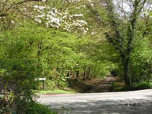
Running the whole length of the lane on the left side is a larch plantation known as College Plantation or Monkton Firs. This tract of woodland once belonged to Merton College, Oxford. The track emerges onto the road at Chapel Hill. This spot marks the meeting point of the Anglo-Saxon Hundreds of Risborough to the north, and Desborough to the south, as well as the Monks Risborough Charter Boundary. Speen Baptist Church is almost opposite .
|
On reaching the Hampden Road, cross over into Bridleway L36
|
 Highwood Bottom
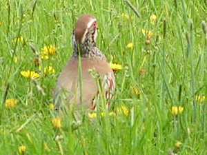 Partridge.
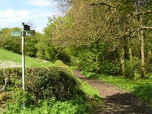 Junction of paths in Highwood Bottom
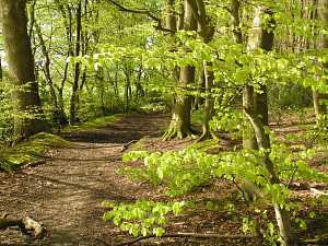 Monkton Wood
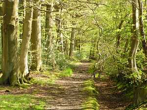 Path along the edge of Monkton Wood
 Coleheath Bottom
> The Llamas the Windmill and the Wardrobes A circular walk to the north of Lacey Green.
A Glimpse of the Promised Land A circular walk, with views over the Saunderton Valley.
Lacey Green Village. Local history, the Windmill and other pages (This website's home page)
Many Photos of Buckinghamshire and Beyond
External pages:
Home of Rest for Horses